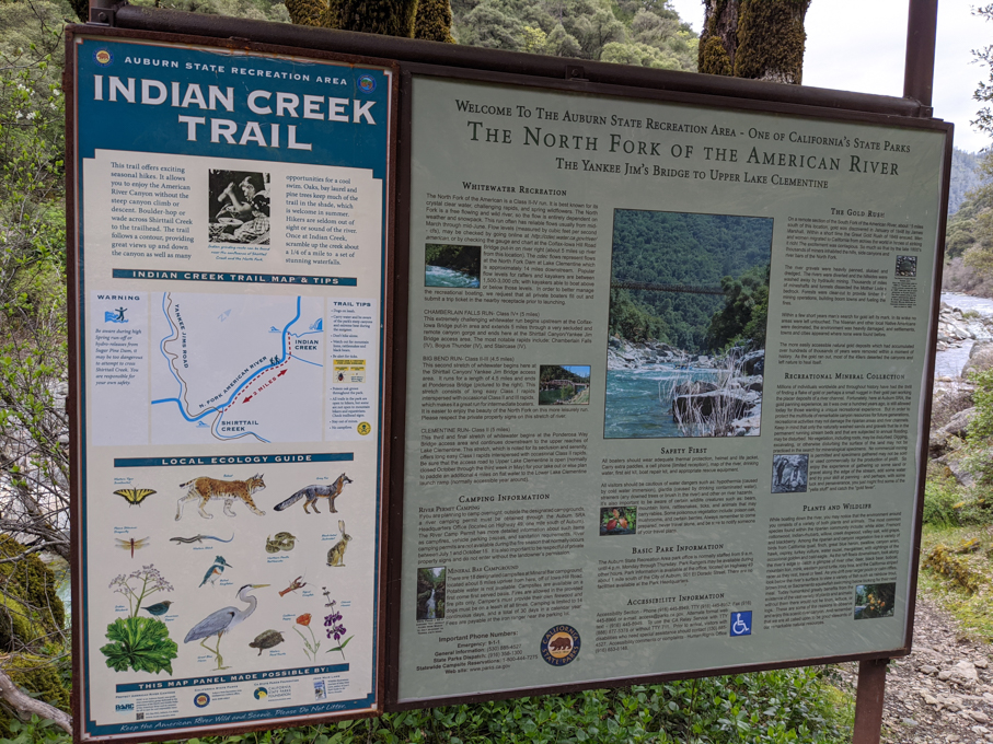
Explore the Crystal Clear Waters and Trails of the North Fork:
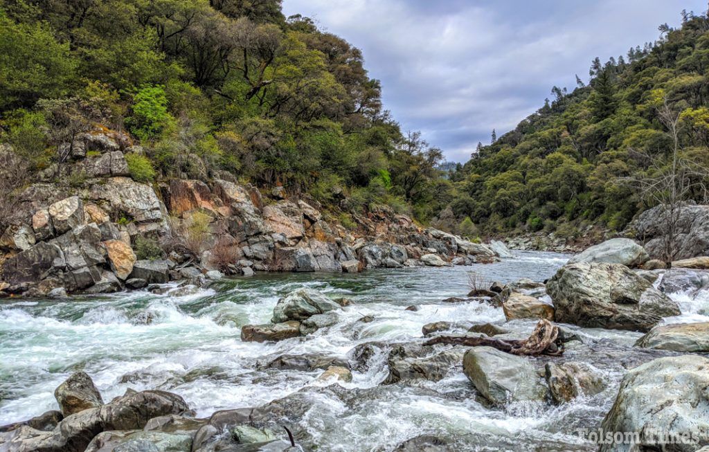
The area around Yankee Jims Bridge in Colfax, along the North Fork of the American River, is a true destination for outdoor enthusiasts. I find myself returning often, rock hopping and exploring the trails whenever I get the chance. When the water is low, you can cross Shirttail Creek and hike approximately two miles along the trail that takes you back to Indian Creek. Along the way, you’ll discover swimming holes filled with crystal-clear water and small white sand beaches—perfect spots for a summer escape. Have you visited Indian Creek Trail? Share your photos using #DayHikerCA!
A Perfect Spot for Swimming and Picnicking:At Indian Creek, you’ll find shady areas and large rocks—ideal for lounging between swims or while enjoying a picnic. During blackberry season, you’ll be treated to an added snack as the vines burst with ripe fruit. The views of the North Fork, deep in the canyon surrounded by forest-covered hills, are as picturesque as it gets. The trail continues on to Windy Point for those up for more of a challenge, but on my most recent visit, I kept it to a two-mile hike in, making for a four-mile round trip.
Trail Conditions and What to Expect:This trail is not consistently maintained, so be prepared for blackberry vines, downed trees, overhanging limbs, and tall grass (home to ticks). Watch out for loose rock, which can be an added hazard, and poison oak for those sensitive to it. Sturdy shoes, walking sticks, and appropriate trail gear are a must.
Parking and Access Information:Parking can be challenging, especially on weekends. Note that this area is within the Auburn State Recreation Area, and a $10 state park day-use fee applies.
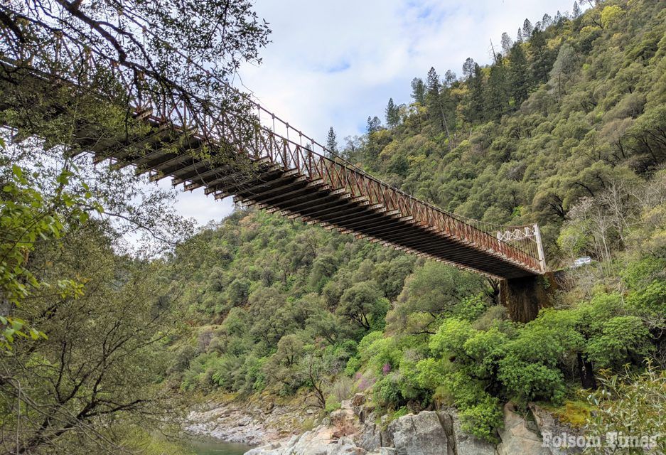
Directions to Yankee Jims Bridge:Take Interstate 80 East to the Colfax exit. Exit onto Canyon Way, and turn right. Less than a mile down the road, you’ll see Yankee Jim’s on the left. Follow Yankee Jim’s Road down to the bridge; note that the pavement ends, and the road follows the mountainside. Park near the bridge.
Tips for a Safe and Enjoyable Hike:Time Your Visit: Start early, as much of the trail is exposed to direct sun and can get hot. Bringing plenty of water and a hiking buddy is always a good idea. Trail Gear: Hats, sunblock, sturdy shoes, and walking sticks are recommended to help navigate the trail’s rocky terrain and provide sun protection.
Have you explored Indian Creek Trail or swam in its clear waters?What’s your favorite spot along the way? Tag @MaryWestHikes on social media and share your stories!
A Side Trip to Devil’s Falls:If you’re up for a little side adventure, about half a mile beyond the bridge on the Foresthill side is Devil’s Falls. There’s something revitalizing about standing under a waterfall—letting the rush of water wash away your worries, even if just for a moment. Devil’s Falls is conveniently located right off the roadside, making it an easy detour that’s well worth the stop.
Mary West is the author of the book series, Day Hiker – Gold Country Trail Guide (I, II, III, and now IV). The books compile her Day Hiker columns, sharing her long-time love for the outdoors and favorite hikes in Northern California’s Gold Country and beyond. West received the 2017 and 2019 CRAFT Awards for Best Outdoor Column, as well as the 2020 CRAFT Award for her second book in the series from the Outdoor Writers of California. Follow her on Facebook and Instagram for more trail inspiration.


