With Sierra snowfall topping 5 feet and Folsom Lake reaching 114% of average, region braces for another wallop Thursday
Mother Nature continues her relentless assault on Northern California, burying the Sierra under feet of snow, drenching the valley with inches of rain, swelling Folsom Lake well above seasonal averages and keeping local crews scrambling — and now forecasters say another round of rain and snow is moving in overnight, with even lower snow levels possible by Thursday morning.
If the past several days were round one, meteorologists warn the next surge could compound already dangerous conditions across the region.
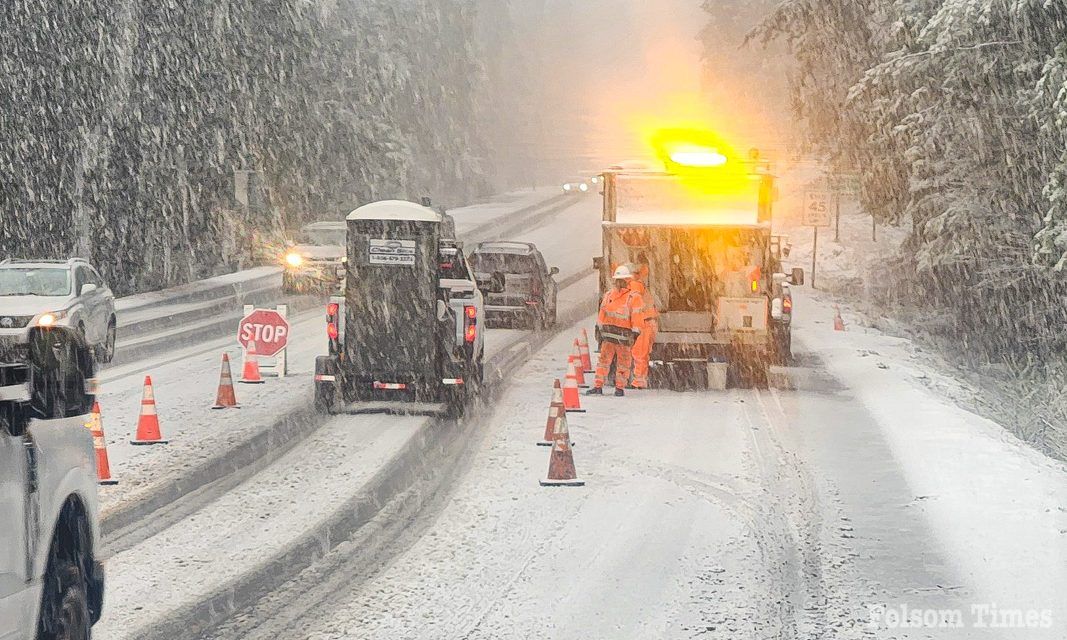
Just hours after a historic winter storm forced the closure of Interstate 80 and Highway 50 for nearly 24 hours, the next system is lining up behind it. Cold air remains firmly in place across the region, setting the stage for additional snowfall in the Sierra and the possibility of light snow reaching unusually low elevations in the northern Sacramento Valley.
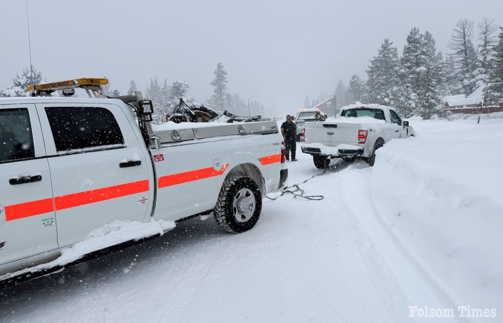
The first wave of the storm shut down Interstate 80 from Colfax to the Nevada state line; closed Highway 50 from Placerville to Meyers amid spinouts and whiteout conditions; and forced the closure of State Route 88. Snowfall rates near Donner Summit reached 3 to 4 inches per hour at times, creating near-zero visibility and extended chain controls across multiple corridors.
New snowfall reports submitted to the National Weather Service now illustrate just how significant this event has been.
In Placer County, 3 miles south of Soda Springs recorded 68.7 inches of snow — nearly six feet — while Blue Canyon measured 62 inches and near Donner Peak totals reached 57 inches; in El Dorado County, 3 miles east-southeast of Twin Bridges reported 61 inches, with Grizzly Flat measuring 24 inches and Camino recording 11.4 inches; Alpine County saw 61 inches near Kirkwood Meadows and 56 inches near Bear Valley; in Nevada County, 1 mile north-northwest of Cisco measured 58 inches, 1 mile east-northeast of Soda Springs recorded 55 inches, Kingvale reported 44 inches, Lake Spaulding measured 36 inches and Cedar Ridge saw 15 inches, while Alta Sierra locations reported between 4 and 6.9 inches; Tuolumne County logged 52 inches near Pinecrest, with Twain Harte measuring 9.5 inches and Soulsbyville recording 8.5 inches; Calaveras County reported 42 inches near Arnold at higher elevations and 22 inches slightly lower; Plumas County recorded 16.5 inches near Quincy and 14 inches near Almanor; Shasta County reported 5.4 inches near Shingletown; and Sierra County measured 17.5 inches near Camptonville.
In many Sierra communities, totals have now approached or exceeded five feet — an amount that explains the widespread highway shutdowns, unstable snowpack and extreme avalanche danger gripping the backcountry.
The storm has also turned deadly. Authorities confirmed Wednesday that eight skiers were killed in Tuesday’s avalanche near Castle Peak outside Truckee. One skier remains missing as search and rescue crews continue operations in treacherous terrain. Six others from the guided group were rescued after hours of difficult efforts involving 46 responders from multiple regional agencies. The Sierra Avalanche Center had issued a high avalanche danger warning prior to the slide, citing unstable snow conditions — a concern that remains as additional snow is forecast.
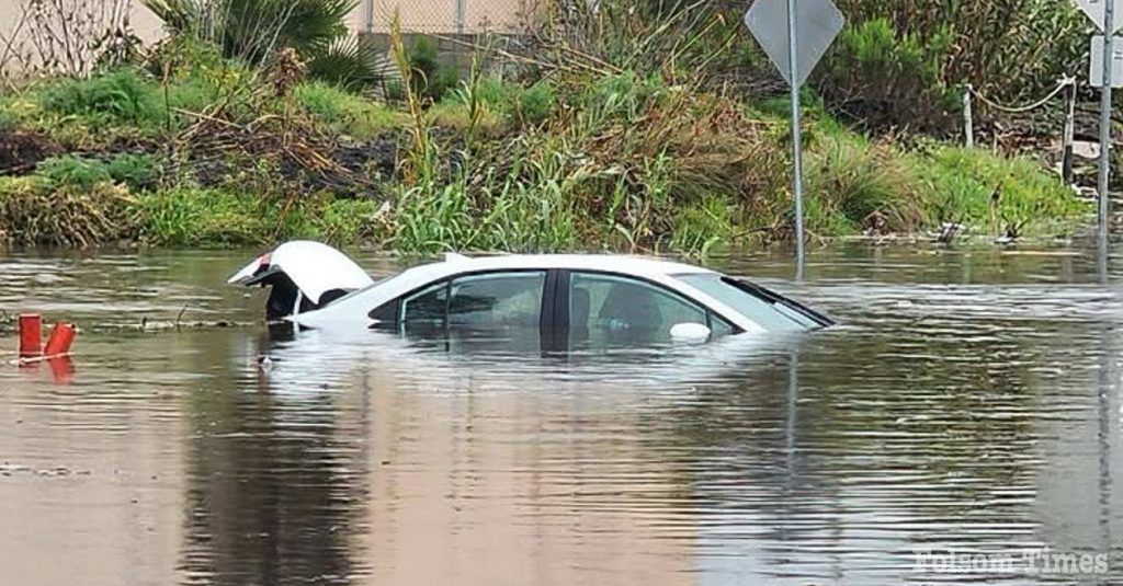
While the mountains were buried in snow, the Sacramento Valley and foothills were drenched in heavy rainfall.
Observed precipitation totals show widespread rainfall between 2 and 4 inches across much of the Central Valley; Red Bluff recorded 2 to 3 inches; Chico and Marysville measured 3 to 4 inches; Sacramento, Stockton and Modesto reported roughly 2 to 3 inches; Placerville saw between 4 and 6 inches of liquid precipitation; Blue Canyon recorded 3 to 4 inches of precipitation equivalent; coastal range locations measured between 1.5 and 2 inches; and San Francisco and San Jose also reported 2 to 3 inches during the multi-day storm cycle.
The combination of deep Sierra snowfall and multiple inches of valley rainfall has saturated soils, swelled creeks and pushed significant runoff into regional reservoirs.
For Folsom residents, the most visible impact is unfolding at Folsom Lake, along with a good dose of roadway flooding in various areas across the city that has kept public works crews busy and motorists on edge. Periods of steady rainfall have led to ponding on roadways and localized flooding in low-lying areas, creating slick driving conditions and prompting crews to monitor storm drains and drainage systems throughout the city.
As of the latest data, Folsom Lake stands at approximately 538,875 acre-feet of storage — 55 percent of its total capacity of 977,000 acre-feet and 114 percent of the historical average for this date. Reservoir elevation is hovering between 420 and 421 feet above sea level.
Inflow into the lake has surged to roughly 8,861 cubic feet per second, far exceeding outflow of approximately 1,890 cubic feet per second. No surcharge releases have been reported.
Those figures reflect heavy runoff from the American River watershed as rain falls at lower elevations and snow continues piling up higher in the Sierra. With additional precipitation expected overnight and Thursday, inflow levels could fluctuate further as more water works its way downstream.
Forecasters now warn that the next wave could bring even lower snow levels. Light snow may fall as far down as Red Bluff early Thursday morning. Snow levels are expected to range between 1,500 and 2,500 feet but could dip to 1,000 feet in the Sierra — and possibly as low as 300 feet in parts of Shasta and Tehama counties during heavier bursts.
Additional snowfall of 1 to 3 feet is forecast above 3,000 feet through Thursday evening, with up to a foot possible between 1,000 and 3,000 feet. Lower elevations in the northern Sacramento Valley could see up to 2 inches in isolated locations.
Projected additional snowfall along Interstate 80 includes approximately 6 inches near Colfax, 22 inches near Alta, 29 inches at Blue Canyon, 30 inches near Kingvale and 23 inches at Donner Pass. Truckee could receive another 10 inches.
Wind gusts between 45 and 55 mph remain possible in exposed areas, increasing the risk of additional tree damage and scattered power outages, particularly where heavy, wet snow continues to burden already stressed trees and infrastructure.
The National Weather Service continues to classify impacts as major, citing whiteout conditions, chain controls, road closures and hazardous travel. Although portions of Interstate 80 and Highway 50 have reopened following temporary lulls, significant restrictions remain in place, and officials strongly discourage unnecessary mountain travel.
The winter storm warning remains in effect through 10 p.m. Thursday as Northern California remains locked in an active and dangerous winter pattern.
After delivering nearly six feet of snow in parts of the Sierra, drenching the valley with inches of rain, swelling Folsom Lake above seasonal averages, triggering deadly avalanche conditions and flooding local roadways, this storm cycle is far from over.
More rain and snow are moving in overnight — and Mother Nature appears determined to keep pressing.
Latest Snowfall Totals Reported
Placer County: 3 S Soda Springs — 68.7 inches; 2 SW Blue Canyon — 62.0 inches; 1 W Donner Peak — 57.0 inches; 3 SW Blue Canyon — 26.0 inches; 4 N Iowa Hill — 16.5 inches; 2 W Baxter — 8.0 inches.
El Dorado County: 3 ESE Twin Bridges — 61.0 inches; Grizzly Flat — 24.0 inches; 1 NW Camino — 11.4 inches.
Alpine County: 1 S Kirkwood Meadows — 61.0 inches; 2 N Bear Valley — 56.0 inches.
Nevada County: 1 NNW Cisco — 58.0 inches; 1 ENE Soda Springs — 55.0 inches; 2 NE Soda Springs — 45.0 inches; Kingvale — 44.0 inches; Soda Springs — 38.0 inches; 2 E Lake Spaulding — 36.0 inches; 3 ESE Cedar Ridge — 15.0 inches; 2 NNE Alta Sierra — 6.9 inches; 1 NNW Alta Sierra — 4.0 inches; 2 SW Bald Mountain Summit — 3.2 inches.
Tuolumne County: 2 E Pinecrest — 52.0 inches; Twain Harte — 9.5 inches; 1 E Soulsbyville — 8.5 inches; 1 ENE East Sonora — 3.7 inches.
Calaveras County: 2 NNE Arnold — 42.0 inches; 1 NNE Arnold — 22.0 inches.
Plumas County: 1 E Quincy — 16.5 inches; 1 SE Almanor — 14.0 inches; 1 NE Chester — 9.0 inches.
Shasta County: 3 ENE Shingletown — 5.4 inches.
Sierra County: 4 NNE Camptonville — 17.5 inches.
Amador County: 1 N Clinton — 4.0 inches; 1 SE Pine Grove — 2.5 inches; Fiddletown — 1.0 inch.
Copyright © 2026, Folsom Times, a digital product of All Town Media LLC. All rights reserved. No portion of this publication may be reproduced, distributed, or transmitted in any form or by any means, without the prior written permission of the publisher.


